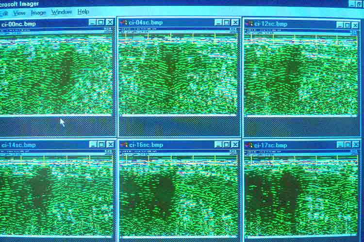
Photo 33. GPR profiles of the trench
detected about 10 meters east of the Castillo Pyramid. From upper
left-to-right are radar profiles at OO north, 4 meters south, 12 meters
south. Lower left-to-right are profiles
at 14 meters south, 16 meters south and
17 meters south. Radar transects were made from west to east.
The dark area represents the trench
which is filled by rubble, and the green is plaza constructed
by the Maya. Note that the trench
appears to open to the west (left) in profiles 14S, 16S,
and 17S toward the east stairway.
Courtesy of William Sauck, 1997.